Where Weather Data Really Comes From — And Why It Matters in an Investigation
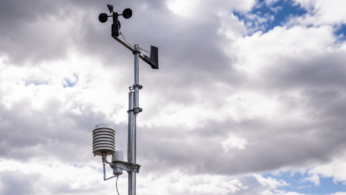
Ask most people how a forecast gets made and they'll shrug. But behind every forecast, climate report, or courtroom weather analysis sits a mountain of raw observation data, collected minute by minute by machines and volunteers scattered across the country. Before anyone can say with confidence what the atmosphere was doing over a specific address at a specific hour, someone or something had to measure it first.
At Atlantic States Weather, Inc. (ASW), that raw data is the starting point for everything — reconstructing storms, supporting litigation, and building expert reports that can withstand scrutiny in a legal setting. It helps to understand how that information is actually gathered, because it's a lot more involved than pulling up an old forecast online.
The Variables That Get Measured
Temperature. Sensors live inside ventilated shields — enclosures that let air circulate while keeping direct sun off the instrument, since sunlight alone can push a reading artificially high. Most stations log a reading every minute or less, and those get rolled into hourly figures that become part of the permanent climate record. That record ends up mattering more than people expect: it's what tells you whether a road had actually iced over, whether a crop died from heat rather than something else, or whether the weather at the time backs up an injury claim.
Wind. Anemometers and wind vanes are mounted well off the ground, usually at a height of 10 meters or 33 feet. When investigators dig into wind data, they're usually after sustained speeds and gust speeds,direction, and duration, and how all of that changed as the event unfolded. One station rarely tells the whole story — comparing several sites, plus accounting for terrain and elevation, is often what it takes to make sense of a collapsed roof, a downed tree, or an incident on the water.
Visibility. This one measures how far the eye could actually see through the air at a given moment. Fog, rain, smoke, haze, blowing snow: anything suspended in the air cuts visibility down, and the sensors pick this up by tracking how light scatters when it hits those particles. In a transportation case, the gap between a mile of visibility and a few hundred feet isn't a minor detail, it can decide the case.
Humidity. This gets calculated from temperature and dew point together, and relative humidity feeds into a surprising number of things: fog formation, thunderstorm development, heat index, frost risk, fire danger. In injury or property claims where moisture in the air played some role, it's often the detail that fills out the picture.
Sky cover. Some stations still use trained observers to classify how much of the sky is covered — clear, mostly clear, partly cloudy, mostly cloudy, overcast — while others rely on automated sensors to do it. Either way, this is the data that helps reconstruct what the lighting looked like, how much solar heating was happening, and how a storm was developing at a particular moment.
Rainfall. Precipitation gets watched closely, since even small differences in totals can flip the outcome of a heavy rainfall dispute. Most stations use tipping-bucket gauges, which record rainfall in small increments throughout a storm, and volunteer-run manual gauges cover the gaps in between. Historical rainfall totals get pulled all the time in flood investigations, construction delay claims, crop-loss disputes. Additionally, doppler radar products can help determine precipitation at a specific location.
Who's Actually Collecting This Data
There isn't one single source. Meteorologists typically pull from several networks and compare them to build a fuller picture. While there are many others, here are a few of the mostly frequently used sources:
ASOS (Automated Surface Observing System) is run jointly by NOAA, the National Weather Service, and the FAA. Stations are spread across the country, and they continuously track temperature, dew point, wind, visibility, cloud height, pressure, and precipitation. Because these stations run around the clock under strict quality control, they're often treated as the backbone of the official record.
AWOS (Automated Weather Observing System) is operated by the FAA and various state aviation agencies, primarily to give pilots real-time conditions. It's aviation-focused, but it's also a key resource for historical weather analysis.
CoCoRaHS (Community Collaborative Rain, Hail & Snow Network) is made up of thousands of volunteers who measure daily precipitation with standardized equipment. Because these observers are scattered through both cities and rural areas, they often catch highly localized rain or hail totals, which matters a lot for flash flooding cases.
COOP (Cooperative Observer Program) has been running for more than a hundred years, with volunteers logging daily high and low temperatures, rainfall, snowfall, and snow depth. Many of these stations have decades of unbroken records, which makes them a go-to resource for long-term climate analysis.
Mesonets: A network of automated weather and environmental monitoring stations operated by states and organizations, designed to observe mesoscale meteorological phenomena and microclimates.
Why It Takes More Than One Source
Weather isn't consistent across even short distances. A storm can drop an inch of rain on one property and barely leave the pavement wet a few miles over. One neighborhood gets hit with damaging straight-line winds while the station down the road shows nothing out of the ordinary. That's the reason a single data point rarely tells the full story. Meteorologists pull from multiple networks, radar, satellite imagery, and numerical models together, rather than leaning on any one source by itself.
Putting It All Together
For ASW, this layered approach to data is the foundation of every forensic weather report — whether the case involves hurricane winds, severe thunderstorms, flooding, winter weather, or conditions on the water. Gathering and interrupting data from multiple data sources like ASOS, AWOS, CoCoRaHS, COOP, plus decades of hands-on meteorological experience is what separates a defensible expert analysis from a guess. When weather ends up mattering in litigation, an insurance claim, a personal injury case, or an infrastructure decision, that's the difference between an opinion and evidence that holds up.